Cartography
Cartography is the art and science of creating, studying, and distributing maps and other visual representations of geographical areas. It involves a combination of scientific and artistic skills to communicate information about a place. In this workshop module, you will learn about the history and modern applications of cartography, followed by some specific demonstrations on the art of map making and advanced map making in ArcGIS Pro.
Brief History of Cartography
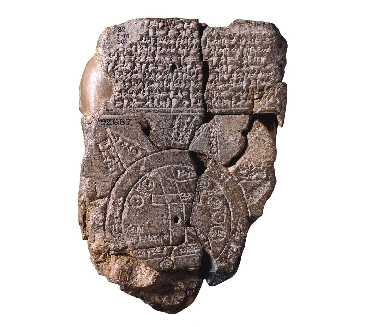
In our modern world, we have access to detailed street maps, global satellite imagery, and GPS navigation. Through these tools, maps are often seen as direct representations of our environment - but how did we arrive at this point? Maps are one of the oldest forms of human communication, serving as tools which help us make sense of our surroundings at various scales (Harley and Woodward 1994). Historically, the map served as an appealing method of communication since it did not require formal literacy from its’ creator or user. However, this does not mean maps were easy to produce - having to provide two-dimensional combinations of shapes, sizes and orientations between locations. Indeed, many early maps failed to to take one or more of these elements into account, resulting in maps they may be more symbolic that literal in their representation of the world. Today, many of these works are on display at museums across the world, valued as anthropological artifacts mroe than as geographic reference material. For example, one of the earliest and most famous world maps was produced on clay tablets in Babylon ~ 600 BCE. This map captured the Babylon and Euphrates rivers, along with the neighboring cities of Assyria and Susa. Outside the circular disk representing the known world, triangular shapes point to lands from Babylonian myth and cosmology (“Babylonian World Map Tablet,” n.d.)
As scientific knowledge advanced throughout classical antiquity, advances in mapping followed suit. The Greeks were among the first to explore mathematical concepts for representing the Earth’s curved surface on a two-dimensional plane - starting in the 6th century BCE. It wasn’t until the 2nd century CE however, that Greek Mathematician and Astrologer Ptolemy (100-170 CE) produced the planishpaerium, a celestial chart mapping stars onto a two-dimensional plane using the first stereographic projection (Harley and Woodward 1994). His geographia provided an instructional framework for the projection of geographic coordinates onto two-dimensional planes, forming the foundation of cartographic advances for centuries to come. Shortly after Ptolemy’s success in the Western world, Chinese cartographer Pei Xiu (224-271 CE) revolutionized map-making in China by prescribing key principles for the use of rectangular grids and graduated scales in measuring distances for the creation of maps.
During the middle ages (5th to 15th centuries) advancement in map-making was largely concentrated in the Islamic world. Built on the foundations of Ptolemy’s methods, maps of the known world were expanded and improved based on information from explorers and merchants travelling from the Muslim world to Spain, India, Africa, China and Russia. Notably, the 9th century Persian mathematician and geographer Habash al-Hasib al-Marwazi developed one of the earliest examples of spherical trigonometry in cartography by projecting coordinates to different coordinate systems. Founded in the early 10th century, these methods were applied to develop atlases and world maps at the famous Balkhi school of terrestrial mapping in Baghdad (Wheatley 1996) (Hiatt and Brill Online Books 2021). Meanwhile in Europe, most maps produced during this era served more as symbolic representations than mathematical navigation tools. These maps were not typically made to serve as general reference tools for navigation, typically being confined to specific areas and use-cases (Harley and Woodward 1994). It was not until the 11th century that the transmission of scientific knowledge from the Arabic-Islamic world began to signicantly effect European-Christian life (Hiatt and Brill Online Books 2021).
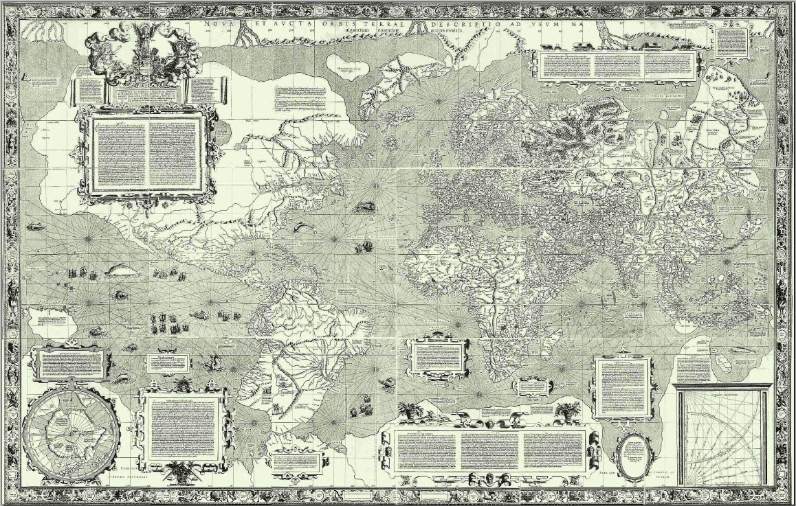
The next major period of cartographic advancement occurred during the ‘Age of Exploration’ (1450-1750 CE), where European nations began navigating and colonizing the globe. With a particular focus on navigating ships across vast oceans, the Mercator projection was invented in 1569 by the Belgian geographer/cartographer Gerardus Mercator (“Gerardus Mercator,” n.d.). Although many advances in cartography have taken place since, the Mercator projection remains possibly the most famous projection of all time, hanging on many a classroom wall to this day.
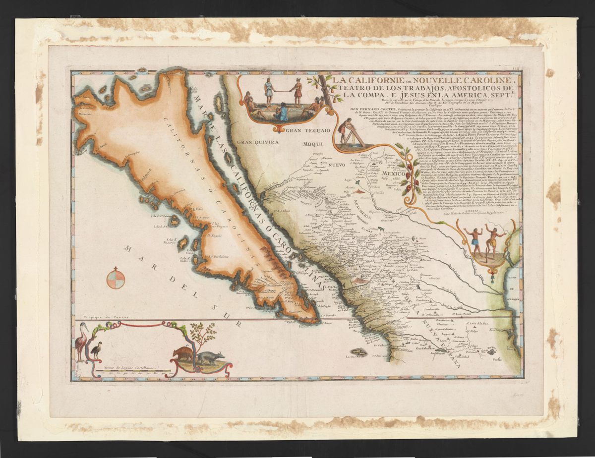
Despite these technological advances in mathematics and map-making, representations of our environments continued to contain notable flaws and mistakes. In the early 1500’s, Spanish author Garcia Rodriguez de Montalvo first described the ‘mythical island’ of California. Despite exploration of the area by explorers (who determined California was a peninsula) map-makers simply denied their claims and continued to portray California as an island over the next two centuries. Although seemingly obvious now, such ‘mistakes’ reflect a core concept of cartography that persists today - that maps reflect knowledge, ideas and assumptions which are a susceptible to human error. In our modern era, we have access to highly accurate information about our environments, countries, cities, navigation routes, etc. Regardless, the way in which we present this information to an audience is an exercise that requires diligence and expertise. In the workshops associated to this Cartography section, we will discuss some key considerations and best-practices for modern map-making.